In the heart of Victoria’s thriving agricultural belt, farmers in Cranbourne are constantly seeking innovative ways to enhance productivity and sustain their precious land. This is where Cranbourne precision farm mapping with drones emerges as a game-changer. SkyShots is at the forefront, offering advanced aerial solutions that provide unparalleled insights into your farm’s health and potential, helping you cultivate smarter, not harder.
Cranbourne, with its rich agricultural history and diverse farming landscapes, from market gardens to grazing pastures, presents unique challenges and opportunities. Traditional scouting methods can be time-consuming and often miss subtle issues that can impact yield. Drones, equipped with cutting-edge sensors, offer a comprehensive bird’s-eye view, capturing detailed data that reveals critical information about crop health, soil variations, and irrigation efficiency with remarkable accuracy.
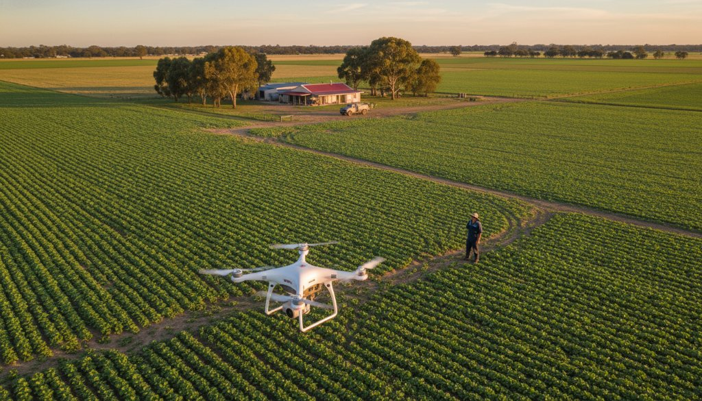
The Power of Aerial Insights for Cranbourne Farms
Imagine knowing the exact stress levels of your crops before visible signs appear, or precisely identifying areas suffering from water scarcity or nutrient deficiencies. This is the power of agricultural drone surveys. Our drones fly over your fields, collecting multispectral and thermal imagery that goes beyond what the human eye can perceive. This data is then processed into detailed maps, providing actionable intelligence for targeted interventions.
- Crop Health Monitoring: Identify diseases, pest infestations, and nutrient deficiencies early, allowing for precise application of treatments.
- Optimised Irrigation: Pinpoint areas of over or under-watering, leading to more efficient water use and reduced costs.
- Soil Analysis: Understand variations in soil composition and moisture levels across your farm for better fertilisation strategies.
- Yield Prediction: Gain a clearer estimation of harvest volumes, assisting with logistics and market planning.
- Infrastructure Planning: Map contours, drainage, and property boundaries with precision, crucial for future development and land management.
Optimising Your Cranbourne Farm with Precision Drone Technology
At SkyShots, we understand the local nuances of farming in Cranbourne, a vibrant part of the City of Casey. Our expert team tailors drone mapping solutions to suit the specific needs of your property, whether you’re growing vegetables, managing livestock, or cultivating broadacre crops. We provide clear, easy-to-understand reports that translate complex data into practical recommendations, helping you make informed decisions that maximise your investment and boost your yields.
We utilise state-of-the-art drone technology to ensure accuracy and efficiency. From flight planning to data processing, every step is handled with meticulous care. Our services are designed to integrate seamlessly into your existing farm management practices, providing a new layer of oversight that saves time, conserves resources, and ultimately leads to more sustainable and profitable outcomes for your Cranbourne farm. Working closely with insights from organisations like Agriculture Victoria, we ensure our methods are aligned with best practices.
Don’t let guesswork impact your harvest. Embrace the future of farming with SkyShots’ comprehensive drone mapping services. From the initial survey to the final report, our commitment is to provide you with the most precise and actionable aerial insights available. Elevate your agricultural practices and unlock the full potential of your land.
Ready to see the difference precision aerial data can make for your Cranbourne farm? Contact SkyShots today for a consultation and discover how our expertise can help you cultivate success. Visit our website or get in touch with our team to learn more about our tailored solutions.
Leave a Reply