Precision Agricultural Drone Surveys Officer: SkyShots Delivers
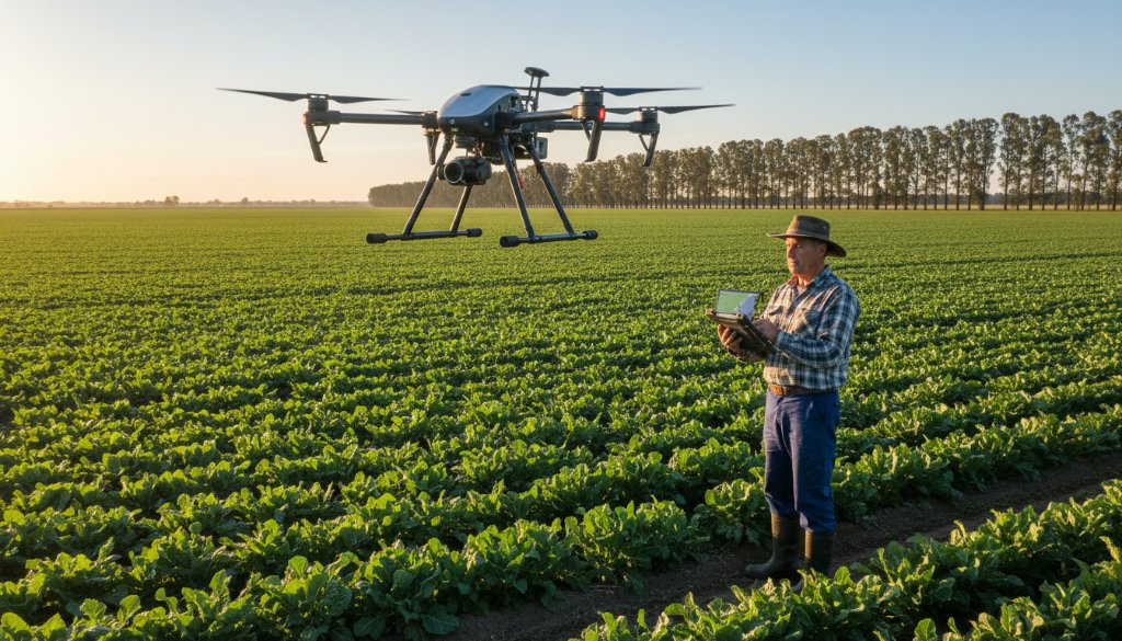
In the evolving landscape of Australian agriculture, farmers in Officer are constantly seeking innovative ways to optimise their yields, manage resources more efficiently, and make data-driven decisions. This is where SkyShots steps in, offering state-of-the-art precision agricultural drone surveys Officer farmers can rely on. Our advanced drone technology provides an unparalleled view of your property, transforming raw data into actionable insights that can significantly boost productivity and sustainability.
Officer, a vibrant area balancing rural charm with urban growth, still has a strong agricultural heart. We understand the unique challenges faced by local farmers – from fluctuating weather patterns to the need for meticulous resource allocation. Our drone services are tailored to address these specific needs, providing detailed aerial perspectives that ground-based methods simply can’t match.
The Future of Farming in Officer
The integration of drones into agricultural practices represents a significant leap forward. For Officer’s farmlands, this means moving beyond traditional observational methods to a sophisticated, data-centric approach. Drones equipped with specialised cameras and sensors can capture multispectral and thermal imagery, revealing hidden details about crop health, irrigation efficacy, and even pest infestations long before they become visible to the naked eye.
Imagine identifying an area of nutrient deficiency or water stress in a specific paddock before it impacts the overall yield. Our advanced drone mapping services make this a reality, providing precise georeferenced maps that allow for targeted interventions, saving both time and valuable resources. This level of precision is not just about increasing output; it’s about fostering more sustainable farming practices that benefit the land and the local community of Officer.
Unlocking Data-Driven Decisions for Officer’s Farmland
SkyShots’ agricultural drone surveys offer a suite of benefits designed to empower Officer farmers:
- Crop Health Monitoring: Detect variations in plant health, identify disease or pest outbreaks, and assess growth stages with high accuracy.
- Irrigation Optimisation: Pinpoint areas of over or under-watering, allowing for precise adjustments that conserve water and improve crop vigour.
- Soil Analysis: Gather data that can indicate soil composition differences, aiding in fertiliser application strategies.
- Yield Prediction: Develop more accurate forecasts of harvest yields, assisting with planning and resource allocation.
- Topographic Mapping: Create detailed 3D models of your terrain, invaluable for drainage planning and land management.
We work closely with local farmers, ensuring our services are aligned with your specific goals and operational requirements. Our pilots are CASA certified and adhere to the highest safety standards, guaranteeing professional and reliable service every time.
Why Choose SkyShots for Your Officer Property?
Choosing SkyShots means partnering with a team that combines cutting-edge technology with local expertise. We’re proud to serve the Officer community and contribute to the success of its agricultural sector. Our commitment to accuracy, efficiency, and customer satisfaction sets us apart. We understand the value of your land and your hard work, and our goal is to provide you with the tools to thrive in a competitive market.
For more insights into local agricultural support, you can visit the Agriculture Victoria website or learn more about the region at the Cardinia Shire Council. We believe in building strong local connections and supporting the communities we serve.
Ready to transform your farm’s potential with unparalleled aerial insights? Discover the difference that professional precision agricultural drone surveys Officer can make. Contact SkyShots today to discuss your specific needs and let us help you cultivate a more productive and sustainable future.
Leave a Reply