Officer construction progress drone photography: Sky-high insights
In the rapidly expanding suburb of Officer, Victoria, new developments are transforming the landscape daily. Keeping a precise eye on these dynamic projects is paramount for success, and that’s where Officer construction progress drone photography by SkyShots makes all the difference. Imagine having an ‘eye in the sky’ providing unparalleled, crystal-clear visual data of your site’s evolution. From foundation to finish, our advanced drone solutions offer a detailed perspective that traditional ground surveys simply can’t match, ensuring your project stays on schedule and within budget.
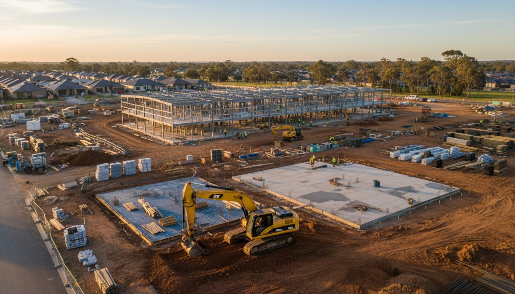
Optimising Officer Construction Progress with Drones
At SkyShots, we understand the unique challenges and opportunities presented by Officer’s vibrant growth. Our aerial photography and videography services are tailored to provide construction project managers, developers, and stakeholders with invaluable insights. We deliver high-resolution imagery and accurate data that can be used for:
- Regular Progress Reports: Document every stage of construction with consistent, repeatable aerial shots. This allows for clear comparisons over time, highlighting both successes and potential bottlenecks.
- Site Planning & Logistics: Gain a comprehensive overview of your site, aiding in the strategic placement of materials, equipment, and access routes.
- Safety & Compliance Monitoring: Identify potential hazards or areas of non-compliance from a safe distance, fostering a safer work environment for everyone on site.
- Stakeholder Communication: Impress investors and keep clients informed with visually stunning and easy-to-understand progress updates.
Our drone technology captures precise geospatial data, offering a level of detail that goes beyond mere photographs. This data can be integrated into existing project management software, streamlining workflows and enhancing decision-making.
Visualising Officer’s Future from Above
Officer is more than just a location; it’s a thriving community with new schools, retail precincts, and residential areas continuously emerging. Our commitment to local businesses means we’re intimately familiar with the region, from the bustling precincts near the Princes Highway to the quieter, developing residential pockets. We pride ourselves on capturing not just the steel and concrete, but also the aspiration and progress that defines Officer’s future. By utilising local expertise, we ensure our commercial drone photography is contextually relevant and impactful.
Think about the sprawling housing estates near the Officer Town Centre or the ongoing infrastructure upgrades – each of these projects benefits immensely from regular aerial monitoring. Our detailed imagery helps project managers at Cardinia Shire Council and private developers alike to oversee multiple sites efficiently, ensuring that the vision for Officer is realised with precision and care. For more information on Victoria’s planning and development, you might visit the Victorian Government planning website.
The SkyShots Difference
Choosing SkyShots for your Officer construction monitoring means partnering with a team that values accuracy, safety, and visual excellence. Our certified drone pilots adhere to the strictest Australian aviation regulations, ensuring every flight is conducted professionally and safely. We offer flexible scheduling to fit your project timelines, delivering timely and actionable reports. Whether you need weekly updates, monthly overviews, or a stunning final project showcase, we tailor our services to meet your specific needs.
Don’t let your next Officer development project be a guessing game. Elevate your project management with high-definition aerial insights. Ready to see your construction site from a new perspective and gain a competitive edge? Contact SkyShots today to discuss how our Officer construction progress drone photography can benefit your next venture.
Leave a Reply