Ensuring Precision in Officer’s Rapid Development
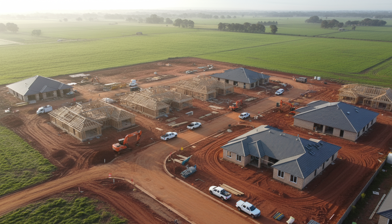
Officer is rapidly transforming into one of the most vibrant residential hubs in the Cardinia Shire. For developers and project managers, keeping a clear eye on site evolution is essential, which is why Officer housing estate drone monitoring services have become a cornerstone of modern project management. At SkyShots, we provide high-resolution aerial documentation that captures every milestone, from initial earthworks to the final roof tiling of new family homes near the local flora of Cardinia Creek.
The pace of development near landmarks like the Officer Train Station and the popular Dragon Park playground is staggering. Stakeholders often find it difficult to maintain a physical presence on-site every day. By utilising professional drone tracking, developers can receive consistent visual updates that ensure the project remains on schedule. These aerial perspectives offer far more detail than ground-level inspections, highlighting potential logistical bottlenecks before they become costly delays. For broader site analysis, our aerial mapping and surveying provides the technical data needed to compliment these visual progress reports.
The Strategic Value of Aerial Progress Reporting
In a competitive market, transparency is everything. Using Officer housing estate drone monitoring allows developers to provide future homeowners with exciting updates on their builds. It builds trust and engagement, showing that the construction is being handled with professional oversight. From a safety perspective, drones allow for site inspections without putting personnel at risk on active work zones, honouring the strict safety protocols required by the Cardinia Shire Council. Whether it is monitoring the drainage installation or the pouring of concrete slabs, the clarity provided by a 4K drone sensor is unparalleled.
Furthermore, the data captured serves as a permanent digital record of the subterranean infrastructure. Knowing exactly where pipes and cables were laid before they were covered by topsoil or bitumen is invaluable for future maintenance. This level of foresight is what separates premium developments from the rest. Our team at SkyShots works closely with site supervisors to ensure our flight paths are consistent, allowing for a seamless time-lapse effect over the duration of the build.
Integrating Drone Data into Project Workflows
The transition from empty paddocks to thriving communities requires meticulous planning and execution. We work with various stakeholders to integrate our imagery into existing project management software. This high-quality visual content is also perfect for marketing, providing stunning shots for real estate photography campaigns as the project nears completion. The ability to showcase the proximity to local schools and the growing infrastructure of the Victorian Planning Authority designated zones adds immense value to the final sale.
As Officer continues to grow towards the horizon, SkyShots remains committed to providing the highest standard of aerial documentation. Our local expertise ensures we understand the specific lighting and weather patterns of the South East, delivering crisp, clear imagery every time. If you are ready to elevate your project oversight and marketing with professional Officer housing estate drone monitoring, contact SkyShots today. Let us help you tell the story of your site’s transformation with clarity and precision.
Leave a Reply