In the heart of Victoria’s food bowl, Werribee’s agricultural landscape is constantly evolving. To thrive, local farmers are seeking innovative solutions for efficiency and productivity. This is where Precision agricultural drone surveys Werribee by SkyShots come into play, offering unparalleled insights that transform how farms are managed.
The Sky-High Advantage for Werribee Farms
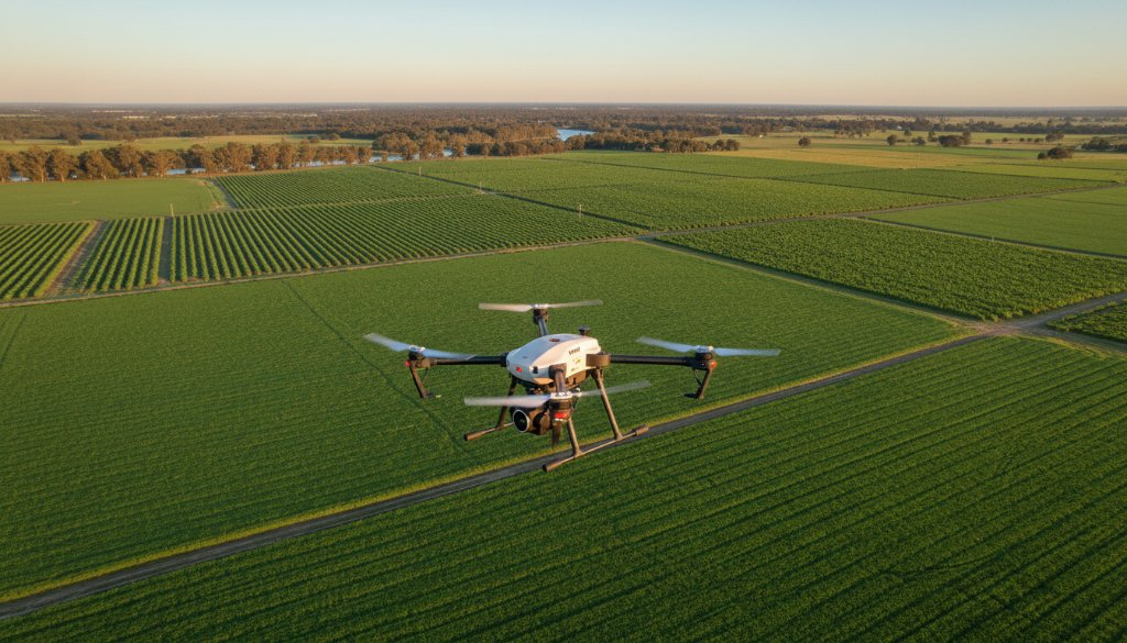
Imagine having a bird’s-eye view of every inch of your property, revealing critical information invisible from the ground. Our state-of-the-art drones capture high-resolution imagery and data, providing Werribee farmers with the intelligence needed to make informed decisions. From assessing crop health to optimising irrigation, drone surveys offer a level of detail that traditional methods simply can’t match. This leads to reduced waste, increased yields, and more sustainable farming practices, crucial for the fertile lands around the Werribee River and beyond.
Unlocking Werribee’s Agricultural Potential with Aerial Mapping
Werribee’s diverse agriculture, from market gardens to sprawling pastoral lands, demands tailored approaches. Our drone mapping services are customised to meet the specific needs of each farm, whether it’s monitoring vineyard vigour or identifying areas needing fertiliser in expansive cropping operations. We understand the local conditions, from the distinct soil types to the unique weather patterns, ensuring our data is always relevant and actionable. Learn more about our specialised services on our Agricultural Drone Surveys page.
Beyond Visuals: Advanced Data for Smarter Farming
At SkyShots, we go beyond simple photographs. Our drones are equipped with advanced sensors, including multispectral and thermal cameras, to gather a wealth of data. Multispectral imaging can detect plant stress before it’s visible to the human eye, allowing for early intervention against diseases or nutrient deficiencies. Thermal imaging helps identify irrigation issues or areas of water stress, ensuring efficient water use – a precious resource in Australia. This comprehensive data suite empowers Werribee farmers to move from reactive problem-solving to proactive management.
The benefits extend to efficient resource allocation, identifying areas that require targeted pest control or precise fertiliser application, saving both time and money. This level of precision farming aligns perfectly with modern agricultural goals for productivity and environmental stewardship. For more information on agricultural best practices in Victoria, visit Agriculture Victoria.
Partnering with SkyShots: Your Local Drone Experts
As a proud Australian business, SkyShots has a deep understanding of the local landscape and the challenges faced by farmers in regions like Werribee. Our team of certified drone pilots and data analysts are committed to providing exceptional service and actionable insights. We pride ourselves on reliability, accuracy, and a friendly, professional approach. When you choose SkyShots, you’re partnering with local experts who are invested in the success of your farm.
Whether your property is near the historic Werribee Mansion or closer to the thriving Werribee CBD, our drones can access and survey your land with minimal disruption. We provide clear, easy-to-understand reports that translate complex data into practical recommendations.
Ready to revolutionise your farm management and boost your yields? Discover the SkyShots difference. Contact us today to discuss how our agricultural drone surveys can benefit your Werribee property. Let us help you cultivate a smarter, more productive future from above!
Leave a Reply