Tracking Development: Officer Construction Progress Drone Photography
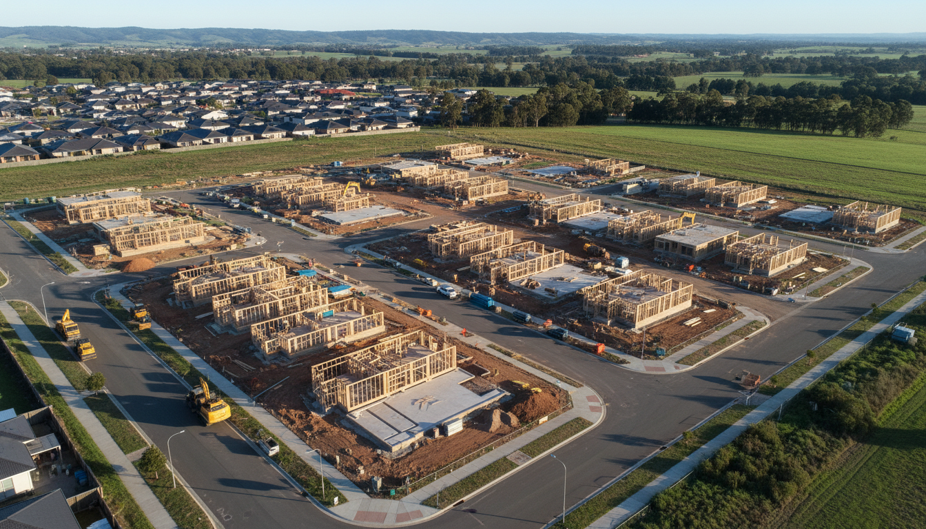
In the rapidly expanding corridor of Melbourne’s South East, Officer construction progress drone photography has become an essential tool for project managers and developers alike. As the landscape around Cardinia Creek transitions from open fields to vibrant residential communities, keeping a pulse on every phase of building is vital. SkyShots provides the high-resolution aerial perspectives needed to document these changes with precision, helping teams stay on schedule and under budget.
Officer is currently one of the fastest-growing suburbs in the Cardinia Shire. With dozens of new residential estates and essential commercial infrastructure appearing monthly, the sheer scale of development can be difficult to grasp from ground level. By utilising our specialised drone services, stakeholders can gain a comprehensive bird’s-eye view of the entire site, ensuring that earthworks, slab pours, and structural framing are proceeding exactly as planned. This level of oversight is invaluable for identifying potential bottlenecks before they become costly delays.
The Advantage of High-Frequency Aerial Monitoring
Regularly scheduled Officer construction progress drone photography offers more than just pretty pictures; it provides a sequential visual record of a project’s lifecycle. These assets are vital for reporting to investors, providing transparency to local councils, and even assisting in dispute resolution should any onsite issues arise. SkyShots delivers consistent, repeatable flight paths, meaning you can compare the exact same angle month-over-month to visualise the building’s evolution clearly.
Enhancing Communication and Marketing
Beyond the technical benefits, aerial imagery is a powerful communication tool. It allows project managers to share updates with remote stakeholders who cannot visit the site in person. Furthermore, the high-quality photos we produce can be repurposed for marketing campaigns to attract future tenants or homeowners. You can see how we apply similar techniques in our real estate drone photography services, highlighting the best features of a property from the sky.
Safety and compliance are at the heart of every SkyShots operation. We understand the complexities of flying near busy areas like the Officer Train Station or along the Princes Highway. Our pilots are fully licensed and insured, ensuring that your site documentation is handled professionally and safely, respecting all local aviation regulations. We work closely with site supervisors to coordinate flights during windows that do not disrupt active works.
Whether you are overseeing a boutique townhouse development near the local schools or a massive commercial precinct, SkyShots is your local partner for aerial excellence in the South East. Our Officer construction progress drone photography gives you the data you need to build with confidence. Contact us today to discuss a custom flight schedule tailored to your project’s specific timeline and goals.
Leave a Reply