The Strategic Advantage of Officer construction site aerial surveys
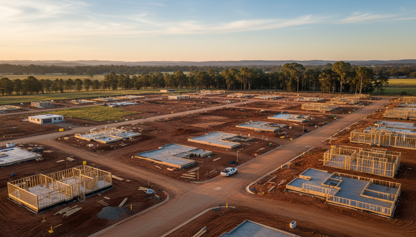
Officer construction site aerial surveys are becoming the gold standard for project managers and developers within the Cardinia Shire. As the suburb undergoes a massive transformation from rural paddocks to a bustling residential hub, the need for precise, high-frequency visual data has never been greater. Whether you are overseeing a new estate near the Princes Highway or managing a commercial build near the Officer train station, drone technology provides a level of oversight that traditional ground-based methods simply cannot match.
By utilising professional construction drone photography, stakeholders can visualise the entire lifecycle of a project. From the initial earthworks at Timbertop to the final landscaping stages of a new community park, aerial imagery offers a comprehensive perspective that aids in logistics, safety compliance, and stakeholder communication. These surveys allow for the identification of potential bottlenecks before they become costly delays, ensuring that projects remain on schedule and within budget.
Visualising Growth with Officer Construction Site Aerial Surveys
Integrating Officer construction site aerial surveys into your workflow does more than just provide pretty pictures; it generates actionable data. High-resolution orthomosaic maps allow site managers to measure stockpiles, track the placement of utilities, and ensure that the build aligns perfectly with the architectural plans. This is particularly vital in rapidly expanding areas like Kaduna Park, where the coordination of multiple contractors requires a single, accurate source of truth. By sharing these updates, teams can collaborate more effectively, even if they are based in Melbourne’s CBD rather than on-site.
Local expertise is crucial when navigating the unique landscape of the South East. Our pilots understand the specific weather patterns of the Officer area and the regulatory requirements set out by the Cardinia Shire Council. This local knowledge ensures that every flight is conducted safely and legally, providing you with peace of mind while we capture the data you need. The ability to show prospective buyers the progress of their future homes in estates like Grandvue or Arcadia also serves as a powerful marketing tool, building trust through transparency.
Enhancing Safety and Precision
Safety is paramount on any active build. By employing Officer construction site aerial surveys, you reduce the need for personnel to navigate hazardous terrain or climb structures for inspections. Drones can easily access hard-to-reach areas, providing crystal-clear imagery of rooflines, cranes, and scaffolding without putting anyone at risk. This proactive approach to site management not only protects your workers but also creates a permanent digital record of the site’s condition at various milestones.
As Officer continues to grow into one of Victoria’s most vibrant communities, SkyShots is proud to support the developers and builders shaping its future. Our commitment to quality and precision ensures that your project is documented with the highest level of professionalism. If you are ready to elevate your project management with high-resolution drone data, contact SkyShots today to discuss a tailored survey schedule that fits your project’s timeline and goals. Let us help you see the bigger picture in Officer.
Leave a Reply