For civil engineering firms and project managers overseeing the dynamic landscape of Box Hill, staying ahead with Box Hill transport infrastructure drone project updates is paramount. SkyShots, Australia’s leading aerial photography experts, offers unparalleled drone photography and videography services, providing critical, real-time insights into the progress and complexities of heavy civil and transport infrastructure projects across Melbourne’s thriving eastern suburbs.
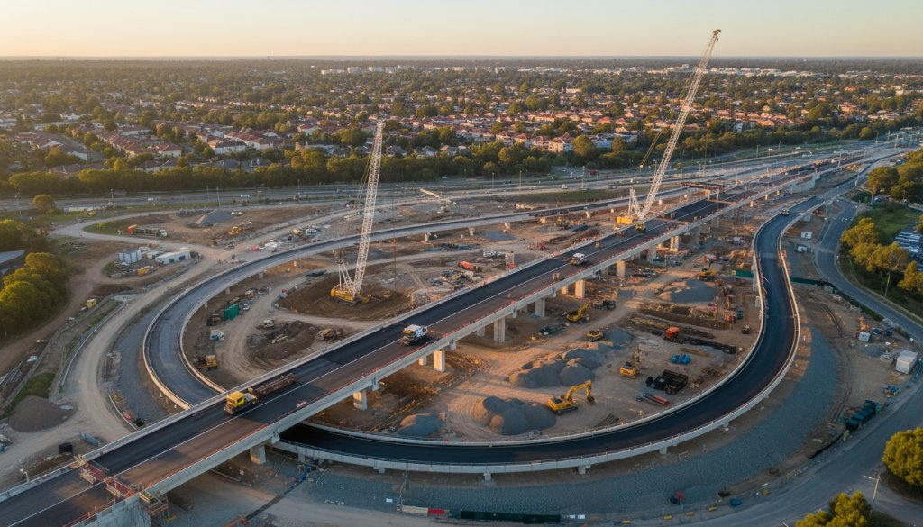
Box Hill, a bustling hub in Greater Melbourne, is constantly evolving, with significant investments in its transport networks. From enhancements to major arterials like the Eastern Freeway corridor to future-proofing for projects such as the Suburban Rail Loop, these developments are shaping the region’s connectivity. Capturing these massive undertakings requires more than just ground-level observation; it demands an elevated perspective that only professional drone technology can provide.
Seamless Box Hill Transport Infrastructure Drone Project Updates
Our drone services deliver comprehensive visual documentation, offering numerous benefits for your project lifecycle. Imagine having weekly or monthly aerial surveys that precisely track construction progress, identify potential issues, and facilitate clear communication among stakeholders. Our high-resolution imagery and video capture every detail, from foundational groundwork and earthmoving to the intricate assembly of multi-level interchanges and bridge constructions. This precision allows for accurate volumetric calculations, environmental monitoring, and meticulous safety assessments, ensuring projects adhere to strict timelines and budget constraints.
Safety on large construction sites, especially those involving significant transport infrastructure, is non-negotiable. Utilising drones from SkyShots drastically reduces the need for personnel to access hazardous areas, protecting your team while still gathering crucial data. Our pilots are fully CASA licensed and adhere to the strictest safety protocols, ensuring every flight over Box Hill’s busy environment is conducted with the utmost professionalism and care.
At SkyShots, we understand the unique challenges of Australian infrastructure projects. We provide tailored solutions that integrate seamlessly into your project management workflows. Our expertise in aerial mapping, 3D modelling, and high-definition visual reporting transforms raw data into actionable intelligence. This means you’re not just getting photos; you’re gaining a powerful tool for informed decision-making.
Moreover, drone photography offers an incredible opportunity for project transparency and public relations. Imagine showcasing the monumental progress of a new road overpass or rail bridge in Box Hill to investors, council members, or the local community through stunning visual narratives. These powerful images communicate dedication, progress, and the positive impact of your work far more effectively than any spreadsheet or written report.
We are proud to contribute to the growth and development of communities like Box Hill, providing the visual evidence that drives successful project completion. Our portfolio of heavy civil and transport infrastructure photography speaks volumes about our commitment to excellence and our capability to handle projects of any scale.
For more information on major transport initiatives in the region, you can visit the Department of Transport Victoria website, or explore local developments through the City of Whitehorse council portal.
Ready to elevate your next infrastructure project in Box Hill? Contact SkyShots today to discuss how our bespoke drone photography and videography services can provide the aerial advantage you need. Visit our contact page to get a quote and see how we can bring your project to new heights.
Leave a Reply