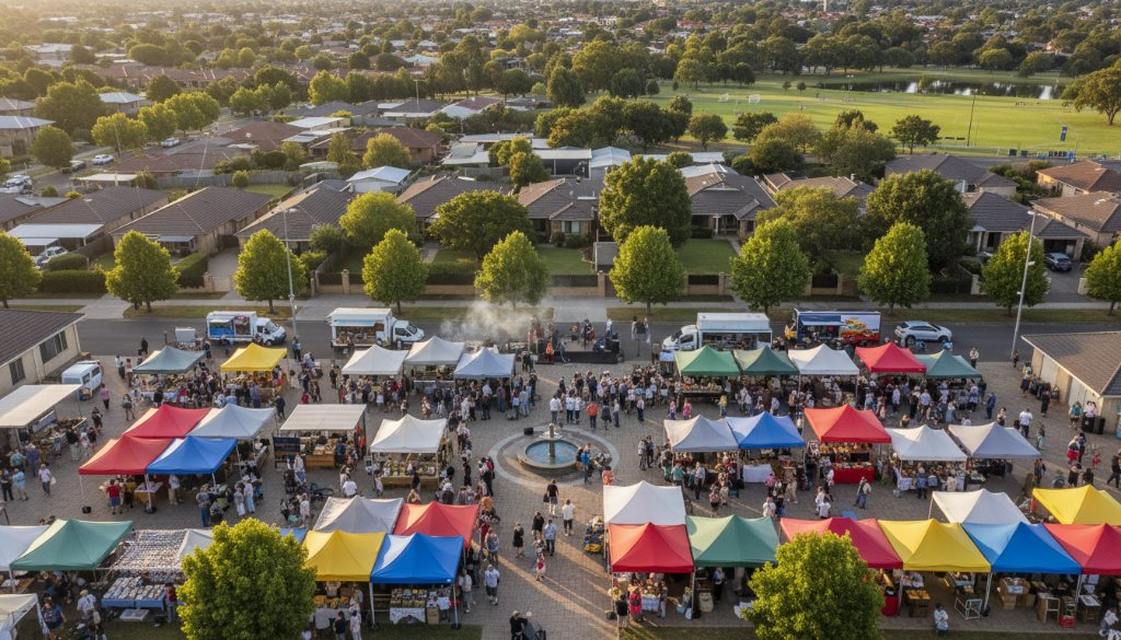
Ever wondered what Cranbourne looks like from a bird’s-eye view? Beyond the bustling streets and familiar parks lies a rich tapestry of community, growth, and natural beauty waiting to be discovered. At SkyShots, we specialise in unlocking these breathtaking perspectives, with a particular focus on Cranbourne neighbourhood aerial photography for community insights. We believe that seeing your world from a new angle can reveal invaluable information, highlight development, and foster a deeper appreciation for your local surroundings.
Unveiling Cranbourne’s Charm from the Sky
Cranbourne, a vibrant and rapidly expanding suburb in Melbourne’s south-east, offers a fascinating landscape for aerial exploration. From the sprawling native flora of the Royal Botanic Gardens Cranbourne to the dynamic sporting facilities of Casey Fields, our drones capture the essence of this thriving community. Imagine an aerial overview showcasing the meticulous urban planning, the lush green spaces intertwining with residential developments, and the flow of daily life that defines Cranbourne.
Our expert pilots navigate the Cranbourne skies with precision, providing high-resolution imagery that goes beyond a simple snapshot. We capture the intricate details of new housing estates, the strategic placement of infrastructure, and the charming layout of established neighbourhoods. This unique vantage point is invaluable for urban planners, real estate developers, and local councils keen to monitor progress and celebrate the growth of their jurisdiction.
Mapping Progress with Precision: Aerial Insights for Cranbourne Development
The continuous development within Cranbourne presents a dynamic canvas. Aerial photography provides an unparalleled tool for understanding this evolution. Whether it’s tracking the progress of commercial hubs near Thompson Parkway, visualising proposed residential expansions, or documenting environmental changes, our services offer a comprehensive visual record. This kind of visual data is crucial for transparent communication with stakeholders and for showcasing the positive impact of local initiatives.
We work closely with various organisations to provide tailored aerial insights. From detailed site analyses for construction projects to broad overviews for strategic planning documents, our imagery serves a multitude of purposes. It helps to illustrate community cohesion, identify areas for improvement, and even tell compelling stories about Cranbourne’s journey as a thriving Australian locale.
Why SkyShots is Your Go-To for Cranbourne Aerial Photography
Choosing SkyShots means partnering with a team of experienced, CASA-certified drone operators who possess intimate knowledge of the Cranbourne area. We don’t just fly drones; we craft visual narratives that resonate. Our commitment to safety, professionalism, and delivering stunning, high-quality results is unwavering. We understand the nuances of Australian light and landscape, ensuring every image we capture is true to life and impactful.
- Local Expertise: Deep familiarity with Cranbourne’s geography and community.
- Cutting-Edge Technology: Utilising the latest drone technology for superior image and video quality.
- Compliance & Safety: Fully insured and compliant with all Australian aviation regulations.
- Tailored Solutions: Custom photographic packages to meet your specific project needs.
Our portfolio extends beyond simple snapshots, offering detailed real estate drone photography, land surveying, and environmental monitoring, all executed with a keen eye for detail and an understanding of our clients’ objectives. We pride ourselves on capturing the authentic beauty and functional aspects of Cranbourne from an elevated perspective.
Ready to see Cranbourne in a whole new light? Whether you’re a local council planning for the future, a developer showcasing a new project, or a community group wanting to highlight local achievements, Cranbourne neighbourhood aerial photography for community insights from SkyShots provides the clarity and visual appeal you need. Connect with us today to discuss how our expert aerial services can elevate your next project.
Leave a Reply