In the bustling industrial heart of Keysborough, where new developments are constantly shaping the landscape, managing large-scale construction projects requires precision, efficiency, and real-time insights. This is where Keysborough drone construction site progress updates from SkyShots become an invaluable asset. Gone are the days of relying solely on ground-level observations or time-consuming manual inspections. Our cutting-edge aerial photography and data collection services offer a revolutionary approach to monitoring, ensuring your projects stay on track, on budget, and on schedule.
The SkyShots Advantage in Keysborough
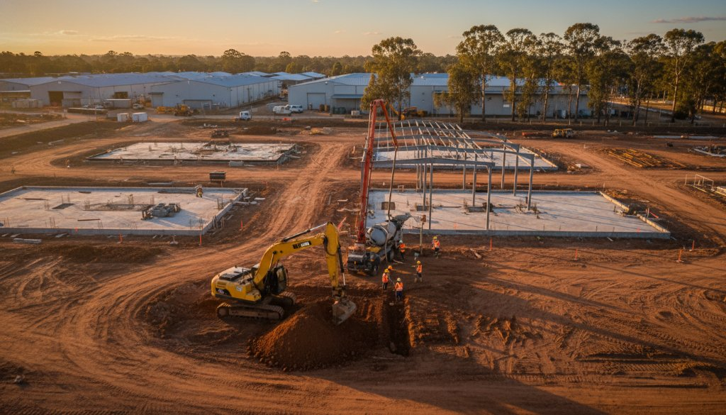
Keysborough’s strategic location, with its strong industrial presence and proximity to major transport arteries like EastLink, makes it a hub for significant development. Whether it’s a new warehouse, a commercial complex, or infrastructure upgrades, our drone technology provides an unparalleled bird’s-eye view. SkyShots leverages advanced drones to capture high-resolution imagery and video, delivering comprehensive progress reports that are far more accurate and efficient than traditional methods.
Our professional drone photography services offer numerous benefits:
- Enhanced Accuracy: Obtain precise measurements, 2D maps, and 3D models of your site, allowing for accurate volumetric calculations and progress tracking.
- Increased Safety: Inspect hard-to-reach areas, tall structures, and hazardous zones without putting personnel at risk.
- Cost-Effectiveness: Reduce the need for expensive equipment and extensive labour hours associated with traditional surveying and inspection methods.
- Timely Reporting: Get regular, consistent updates, enabling project managers to identify potential issues early and make informed decisions.
Real-Time Insights for Smarter Decisions
Imagine having a comprehensive visual record of your construction site’s evolution, week by week, or even day by day. SkyShots provides exactly that. Our drone data can be integrated into your project management workflows, offering visual evidence of work completed, material usage, and resource deployment. For projects across Keysborough, from the Green Triangle industrial estate to newer commercial builds, this level of detail is crucial for effective planning and stakeholder communication.
Beyond Progress Updates: Enhanced Safety and Compliance
While monitoring progress is critical, drone technology also plays a pivotal role in ensuring site safety and regulatory compliance. Our aerial inspections can identify potential hazards, verify adherence to safety protocols, and document site conditions for compliance audits. This proactive approach helps mitigate risks and ensures that your Keysborough construction site operates within Victorian WorkSafe guidelines, contributing to a safer work environment for everyone.
We understand the specific demands of the Australian construction sector and tailor our drone solutions for businesses to meet these challenges head-on. Our reports provide clear, actionable data, giving you peace of mind and the tools to maintain control over your project’s trajectory.
For more information on local planning and development in Keysborough, you can also consult the City of Greater Dandenong website.
Ready to elevate your construction project monitoring in Keysborough? Partner with SkyShots for reliable, high-quality aerial solutions that transform how you manage your builds. Contact us today to discuss your specific needs and discover the power of drone-enabled progress updates.
Leave a Reply