Optimising Project Management in Officer
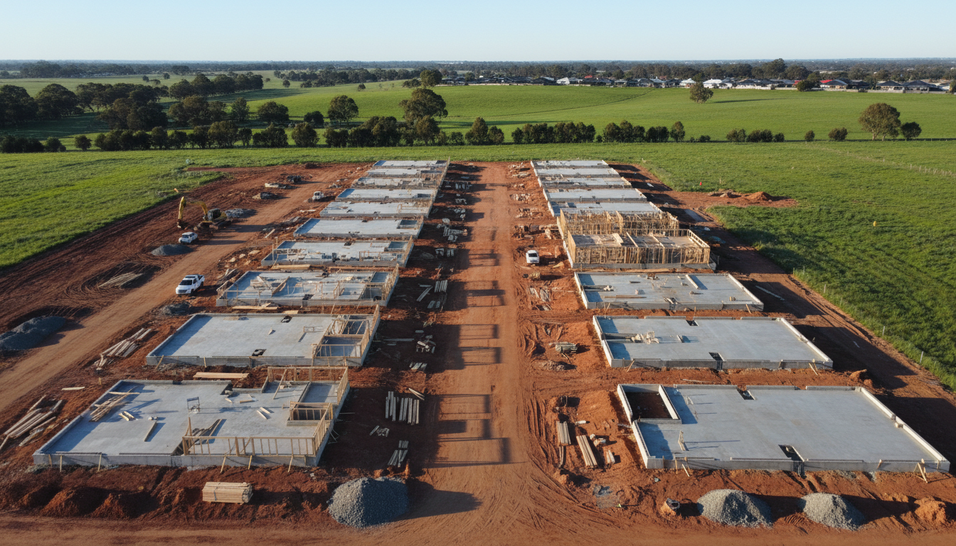
Officer aerial construction site updates are becoming an essential tool for project managers and developers working within the rapidly growing Cardinia Shire. As new residential estates like Arcadia and Kaduna Park continue to expand, the ability to oversee vast sites from a bird’s-eye view provides more than just a visual record; it offers actionable data. At SkyShots, we specialise in delivering high-frequency drone surveys that allow stakeholders to monitor progress, manage sub-contractors, and ensure safety protocols are met without needing to be physically present on-site every day.
Precision Tracking for Growing Estates
The landscape of Officer is changing daily, with new infrastructure projects and residential blocks appearing along the Princes Highway corridor. Utilising professional aerial photography in Melbourne and its surrounding suburbs ensures that every phase of development is documented with millimetre precision. Our drones capture high-resolution imagery that can be used for volumetric measurements of stockpiles, site contouring, and verifying the placement of utilities against original site plans. This level of detail is invaluable for maintaining timelines and budgets in the competitive Victorian property market.
Enhancing Stakeholder Communication
One of the primary benefits of regular drone reporting is the ability to communicate clearly with investors and future residents. Providing high-quality visual updates builds trust and transparency. By integrating our imagery into your monthly reports, you give stakeholders a clear understanding of the project’s evolution. For those interested in the broader development of the region, the Cardinia Shire Council planning portal provides excellent context on the future growth expected in the Officer area, which our aerial services complement by showing real-world progress.
Safety and Site Security
Safety is paramount on any construction site. Frequent aerial flyovers allow site supervisors to identify potential hazards or security breaches from a safe distance. Our drones can access areas that might be difficult or dangerous for personnel to reach, such as high-rise structural components or steep embankments. By choosing SkyShots for your commercial property photography and construction tracking, you are investing in a safer, more efficient workplace. We pride ourselves on our local knowledge of Officer and the unique atmospheric conditions of the south-east, ensuring we fly only when the light and weather are optimal for the highest quality results.
Book Your Officer Site Update Today
If you are ready to elevate your project management with professional Officer aerial construction site updates, SkyShots is here to help. Our team combines technical expertise with a creative eye to deliver images that are as beautiful as they are functional. Let us help you document the transformation of Officer’s landscape with precision and style. Contact us today to discuss a tailored flight schedule for your next development.
Leave a Reply