Officer, a vibrant and rapidly transforming suburb in Melbourne’s south-east, blends its rural heritage with modern family living. To truly appreciate its unique character, a fresh perspective is essential. That’s where Officer aerial home photography perspectives come into their own, offering an unparalleled view of this dynamic community, revealing its hidden beauty and planned growth.
Discovering Officer’s Evolving Charm from Above
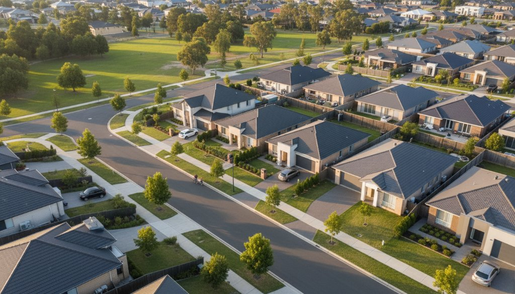
From Officer’s Recreation Reserve to new estates like Timbertop, Officer presents a diverse tapestry of landscapes. Our drone photography captures intricate street layouts, generous block sizes, and how homes integrate with natural surroundings, including majestic gum trees. Imagine seeing your street, your favourite park, or the entire neighbourhood, bathed in soft morning light or vibrant sunset hues. It’s more than a photo; it’s a story of community growth and picturesque living in the Cardinia Shire region. Explore local developments on the Cardinia Shire Council website.
The SkyShots Advantage in Delivering Officer Aerial Home Photography Perspectives
At SkyShots, we specialise in exceptional Officer aerial home photography perspectives. Our experienced pilots and photographers understand the nuances of capturing residential areas. We highlight architectural details, showcase property boundaries, and frame entire neighbourhoods to convey their unique lifestyle. For real estate agents, this means showcasing properties with undeniable wow factor, drawing in potential buyers with comprehensive visual tours from the sky. For homeowners, it’s a chance to immortalise their cherished dwelling from an artistic, elevated viewpoint. Learn more about our real estate services on our Real Estate Drone Photography page.
Beyond Property: Capturing Officer’s Community Life
While invaluable for real estate, our aerial photography extends far beyond. We help local businesses, community groups, and urban planners visualise Officer’s development and infrastructure projects. Imagine documenting a new community hub like the Officer Community Centre or showcasing a local event from an entirely new angle. Aerial views provide context, reveal patterns, and offer a sense of place that ground-level photography cannot achieve. It’s about celebrating Officer’s ongoing story, from its bustling Princes Highway thoroughfare to its quiet cul-de-sacs, and the harmonious blend of established and emerging areas. The Officer Community Centre is a perfect example of community spirit taking flight.
Why Choose Professional Aerial Photography for Your Officer Project?
Opting for professional aerial photography ensures stunning visuals, safety, and compliance. Our SkyShots team adheres to all CASA regulations, providing a seamless and secure experience. We use state-of-the-art drone technology for high-resolution images and videos, ensuring every detail of Officer’s landscape, from wetlands to the distant Dandenong Ranges, is depicted with breathtaking clarity and colour accuracy. This level of detail and professionalism sets your visuals apart, whether for a personal keepsake, a powerful marketing campaign, or a vital community project.
Ready to see Officer from an extraordinary vantage point? Whether you’re looking to showcase a property, document a development, or simply capture the enduring beauty of your neighbourhood from above, SkyShots is here to help. Explore the unique charm and evolving landscape of Officer through the lens of our expert aerial photographers. Contact us today to discuss your vision and discover the transformative power of aerial photography tailored for your Officer project.
Leave a Reply