Visual Precision in the Heart of the Cardinia Shire
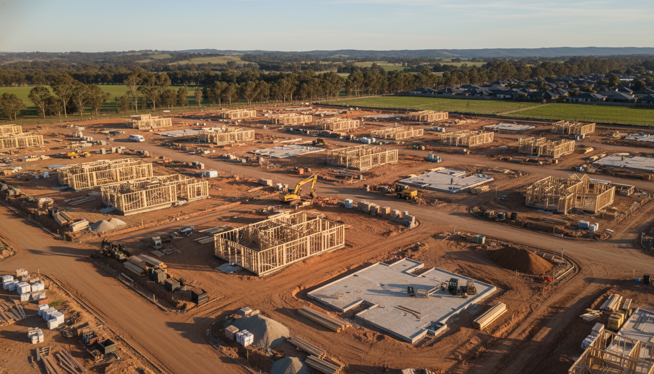
As the landscape of South East Melbourne continues to transform, Officer estate development aerial progress scans have become an indispensable tool for project managers and stakeholders. At SkyShots, we understand that overseeing a large-scale residential project near landmarks like the Timbertop estate or the bustling Arena Shopping Centre requires more than just boots on the ground. It requires a bird’s-eye view that provides clarity, data, and a historical record of every slab poured and frame erected. Our specialised drone services are designed to bridge the gap between site offices and head offices, ensuring that everyone stays informed with high-resolution visual evidence.
Why Construction Tracking is Essential for Officer Projects
The rapid growth within the Cardinia Shire Council region means that timelines are tighter than ever. Utilising Officer estate development aerial progress scans allows developers to identify potential bottlenecks before they become costly delays. Whether you are managing a small subdivision or a massive multi-stage rollout, the ability to compare week-on-week changes from the exact same GPS coordinates is a game-changer for project management. This level of consistency is exactly what our construction photography services offer to local builders.
Enhanced Safety and Stakeholder Transparency
Safety is paramount on any Victorian worksite. Aerial monitoring reduces the need for personnel to navigate hazardous terrain just for a status update. By providing a comprehensive digital twin of the site, we help safety officers maintain high standards in accordance with the Victorian Building Authority guidelines. Furthermore, these high-definition images are perfect for marketing materials and investor updates. Showing a potential buyer the progress of their future home in Officer with stunning aerial clarity builds trust and excitement that ground-level photos simply cannot match.
The SkyShots Advantage for Local Infrastructure
Our team at SkyShots doesn’t just take photos; we capture the evolution of a community. From the first earthworks near the Princes Highway to the final landscaping of a new parkland, our drones document the hard work that goes into building Officer’s future. Our process is seamless, professional, and tailored to the unique lighting and weather conditions of the Gippsland fringe. We use Australian-standard equipment to ensure every pixel serves a purpose, from volumetric measurements to high-impact promotional content.
Secure Your Project’s Legacy with SkyShots
Don’t let your project’s milestones pass by undocumented. Ensure your site is monitored with the precision it deserves. Contact SkyShots today to schedule your first flight and see why we are the preferred partner for aerial surveying and progress tracking in Officer.
Leave a Reply