Scoresby residential drone photography for property insights: Your local guide.
In the thriving eastern suburbs of Melbourne, Scoresby stands out as a vibrant, family-friendly locale. Whether you’re a long-time resident, a potential buyer, or a property developer, understanding the unique tapestry of this neighbourhood from a fresh perspective can be invaluable. This is precisely where Scoresby residential drone photography for property insights truly shines. At SkyShots, we specialise in delivering breathtaking aerial overviews that transform how you see and appreciate local properties, offering clarity and detail unattainable from the ground.
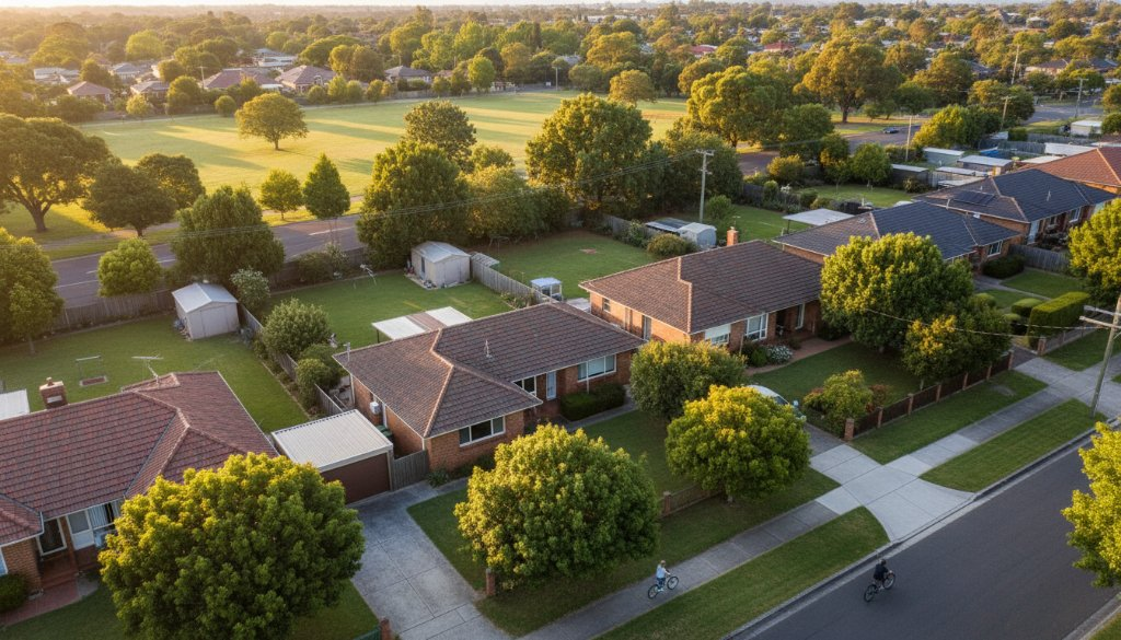
Scoresby boasts a charming mix of established homes, modern developments, and green spaces, making it a highly sought-after area. From the lush expanses of Caribbean Gardens to the convenient connections of EastLink, the suburb offers a blend of community spirit and accessibility. Our drone photography captures these elements, highlighting proximity to amenities, the flow of traffic, and the overall feel of a street or entire block. It’s more than just a photo; it’s an opportunity to gain comprehensive property insights.
Unlocking Property Potential with Aerial Views
For homeowners looking to sell, aerial photography provides a significant edge. Imagine buyers seeing not just your house, but its generous block, manicured garden, and advantageous neighbourhood position. This bird’s-eye view can reveal proximity to local schools, parks, and even highlight privacy – details difficult to convey traditionally. SkyShots ensures every angle is considered, offering a holistic perspective that resonates with discerning buyers.
Real estate agents understand the power of a compelling visual narrative. Integrating professional drone footage into Scoresby listings dramatically increases engagement. Our high-resolution images and videos highlight a property’s unique features, boundaries, and relationship to its environment. Explore our aerial photography services.
Advanced Property Insights for Developers and Investors
Developers and investors in Scoresby leverage drone photography for more than just marketing. Aerial overviews are indispensable for site analysis, planning, and progress tracking. High-quality drone imagery assists in assessing topography, identifying access issues, and visualising development impact. Regular aerial updates monitor construction phases and ensure plan adherence, providing invaluable property insights. Drone photography excels at capturing Scoresby’s essence, showing how new constructions blend with established streets. For local government information, visit Knox City Council. For more examples, browse our neighbourhood overview portfolio.
Beyond property sales and development, drone photography offers a unique way for the Scoresby community to capture memories, document local events, or simply appreciate their home from an entirely new perspective. Imagine a stunning aerial print of your street, capturing the vibrant life of your neighbourhood for years to come.
At SkyShots, we provide unparalleled aerial perspectives across Australia, especially in local Victorian communities like Scoresby. Our licensed and experienced drone pilots use state-of-the-art equipment for sharp, detailed, and legally compliant imagery. If you’re ready to explore the exciting possibilities that Scoresby residential drone photography for property insights can offer, connect with SkyShots today. Let us help you see your world from above.
Leave a Reply