Tarneit, a vibrant and rapidly expanding suburb in Melbourne’s western corridor, presents unique opportunities and challenges for master-plan development. As this dynamic community continues its impressive growth trajectory, precision and foresight are paramount for developers. This is where Tarneit master-plan drone surveying for developers emerges as an indispensable tool, revolutionising how urban landscapes are shaped. At SkyShots, we understand the critical need for accurate, up-to-date topographical data and visual intelligence to underpin successful large-scale projects, from residential estates to commercial hubs.
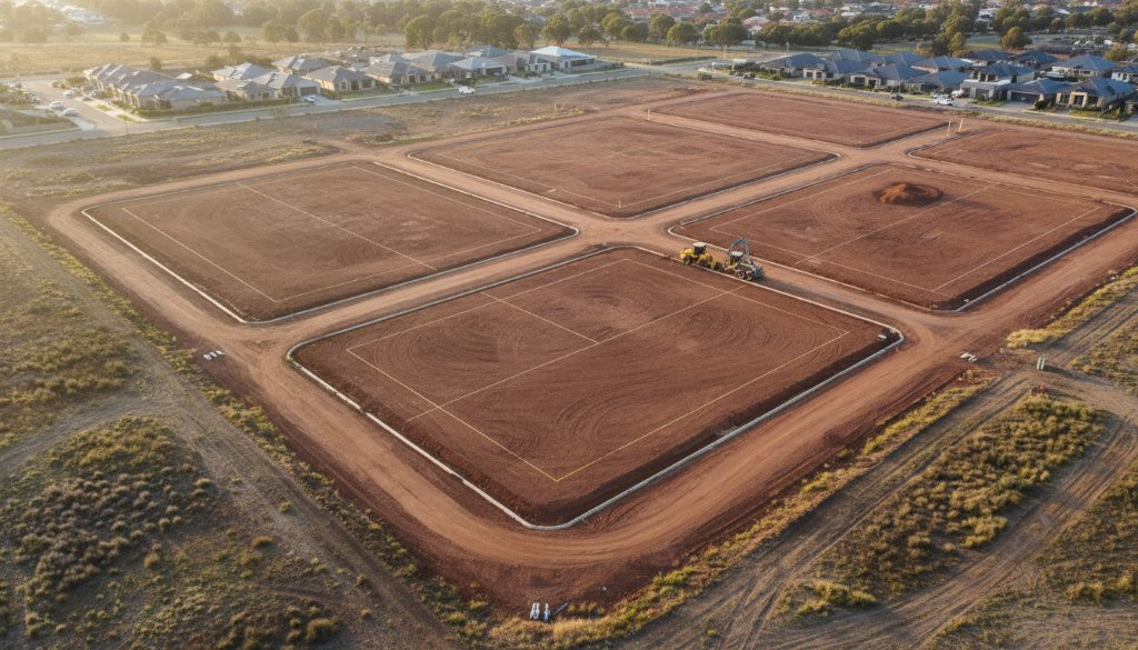
Traditional surveying methods, while accurate, can be time-consuming and costly, especially across vast, undeveloped land parcels characteristic of Tarneit’s growth areas. Drone technology, however, offers an unparalleled advantage, delivering high-resolution imagery and precise data efficiently. From the bustling Tarneit Central Shopping Centre precinct to the tranquil open spaces near Davis Creek, understanding the terrain is crucial for sustainable development. SkyShots provides detailed orthomosaic maps, digital elevation models (DEMs), and 3D models that reveal every contour and feature, enabling developers to make informed decisions faster.
Unlocking Tarneit’s Potential Through Advanced Aerial Data
The accuracy provided by drone surveying goes beyond simple mapping. It allows for meticulous site analysis, identification of potential drainage issues, and precise volume calculations for earthworks. This level of detail is critical for infrastructure planning, ensuring that new roads connecting to Derrimut Road, utility networks, and community facilities are optimally placed. For developments within the Victoria Planning Authority’s growth corridors, adhering to planning regulations is simpler with comprehensive aerial data.
Furthermore, drone imagery aids significantly in stakeholder communication. Presenting potential investors or Wyndham City Council officials with vivid 3D visualisations of a proposed master-plan instils confidence and clarity, fostering smoother approval processes. Visualising future infrastructure, like new parks or proposed commercial zones near the Werribee River tributaries, becomes crystal clear, allowing all parties to grasp the project’s scope and impact.
Why Choose SkyShots for Your Tarneit Master-Plan?
As local aerial photography specialists, SkyShots brings a deep understanding of the Tarneit landscape and its unique development needs. Our experienced pilots and advanced drone technology ensure not only exceptional data quality but also adherence to all safety regulations. We pride ourselves on delivering bespoke surveying solutions that cater specifically to the complexities of large-scale master-plan developments. Whether you’re planning a new residential estate sprawling towards the Western Freeway or a commercial precinct, our mapping services provide the foundational data you need.
We don’t just capture images; we capture intelligence. Our commitment is to provide you with actionable insights that streamline your project timeline, mitigate risks, and ultimately contribute to the successful creation of thriving new communities in Tarneit. Explore our portfolio to see how our precision aerial solutions have empowered other developers.
Ready to elevate your Tarneit master-plan development with unparalleled aerial precision? Contact SkyShots today to discuss your project requirements and discover how our drone surveying expertise can help bring your vision to life.
Leave a Reply