For the hard-working farmers in and around Tullamarine, every growing season brings new challenges and opportunities. Maximising yield, optimising resources, and maintaining crop health are constant priorities. This is where modern innovation steps in, offering a transformative approach to agricultural management. SkyShots is proud to introduce the significant Tullamarine farm drone surveying benefits, bringing precision agriculture to your doorstep.
The Dawn of Precision Agriculture in Tullamarine
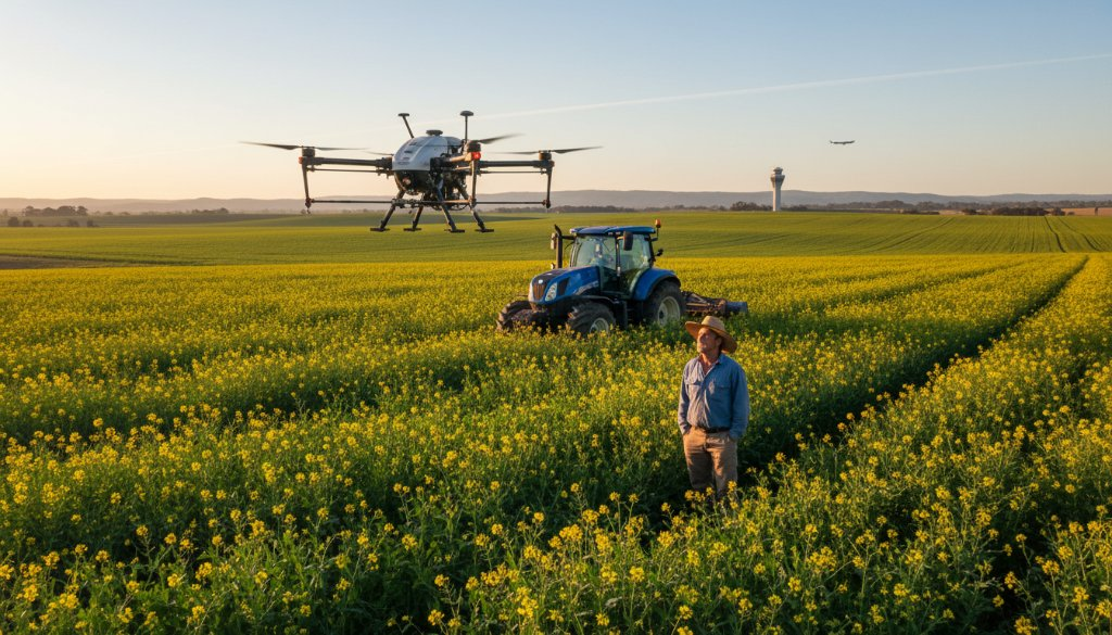
Gone are the days of manual, time-consuming field assessments that often lacked the detail needed for truly informed decisions. Tullamarine, while known for its aviation hub, also boasts a valuable agricultural fringe where smart farming practices are becoming increasingly vital. Our drone surveys provide an unparalleled birds-eye view of your property, capturing data that simply isn’t visible from the ground.
From large-scale cropping operations to smaller, intensive horticultural plots, our advanced drones equipped with multispectral and thermal cameras can detect subtle variations in crop health, irrigation issues, and even pest infestations long before they become visible to the human eye. This proactive approach allows for targeted intervention, saving valuable resources like water and fertiliser, and ultimately protecting your yield. Discover more about our comprehensive drone surveying services on our website.
Unlocking Efficiency: Beyond the Visual
The true power of agricultural drone surveying lies not just in capturing images, but in the sophisticated data analysis that follows. Our drones collect vital metrics such as Normalised Difference Vegetation Index (NDVI) mapping, which illustrates plant vigour and growth patterns. Thermal imaging can pinpoint areas of water stress or disease, while detailed topographical mapping helps optimise irrigation systems and drainage.
Imagine identifying a dry patch in your paddock, invisible from ground level, allowing you to adjust your irrigation to that specific area rather than over-watering healthy sections. Or detecting the early signs of a nutrient deficiency across a specific crop variety, enabling a precise application of amendments. These insights translate directly into healthier crops, reduced waste, and improved profitability for Tullamarine growers.
Why Choose SkyShots for Your Tullamarine Farm?
At SkyShots, we combine cutting-edge drone technology with a deep understanding of Australian agriculture. Our licensed and experienced pilots are adept at navigating the unique landscapes and regulations pertinent to the Tullamarine region, ensuring safe, efficient, and compliant operations. We pride ourselves on delivering actionable insights that empower farmers to make smarter, data-driven decisions.
We understand the local context of farming in areas adjacent to major infrastructure like Melbourne Airport. Our team is skilled in planning flights that respect airspace regulations while still providing comprehensive coverage of your agricultural land. For more information on agricultural practices and resources in Victoria, you can visit the Agriculture Victoria website.
Embrace the future of farming with SkyShots. Unlock the numerous Tullamarine farm drone surveying benefits and transform your agricultural operations. From detailed crop health assessments to precise land mapping, our services are designed to enhance your productivity and sustainability. Contact SkyShots today to discuss how we can tailor a drone surveying solution for your farm.
Leave a Reply