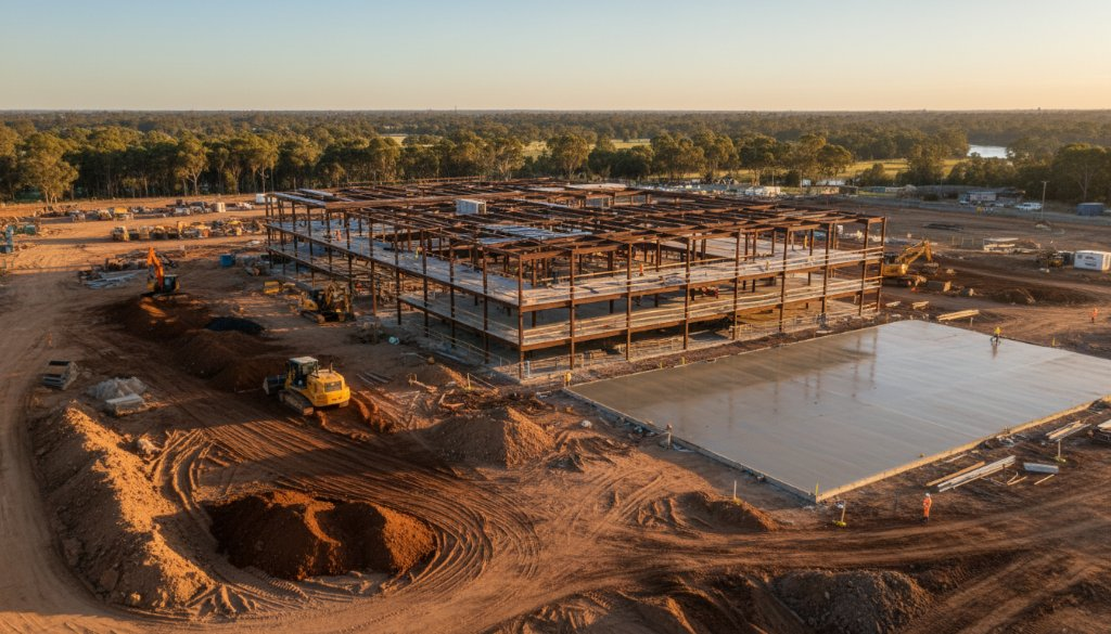
In the dynamic world of Australian construction, staying on top of project progress is paramount. For developers and project managers in Werribee, traditional site visits and manual reporting can be time-consuming and often miss crucial details. That’s where SkyShots comes in, offering unparalleled Werribee construction site drone progress updates that provide a bird’s-eye view of your project’s evolution, transforming how you monitor and manage.
Werribee is a hub of growth, from new residential estates emerging around the Werribee River to commercial developments shaping its urban landscape. Construction projects here demand precision, efficiency, and clear communication. Our advanced drone technology delivers just that, providing high-resolution imagery and data that capture every stage of development with meticulous accuracy. Imagine having a comprehensive visual record, from earthworks to roofing, all at your fingertips.
The SkyShots Advantage in Werribee
At SkyShots, we understand the unique rhythm of construction in Werribee. Our aerial photography services go beyond simple snapshots; we provide detailed visual intelligence. Drones can access hard-to-reach areas, survey vast expanses quickly, and offer perspectives that ground-level photography simply cannot. This not only enhances safety by reducing the need for personnel in hazardous zones but also provides an objective, verifiable record of progress.
Unrivalled Accuracy for Werribee Construction Site Drone Progress Updates
Our drone solutions are engineered for precision. We capture high-resolution photos and videos, enabling you to track specific milestones, identify potential delays, and ensure quality control from a unique vantage point. Whether it’s monitoring the laying of foundations, the erection of structural steel, or the progress of landscaping, our aerial insights empower you to make informed decisions faster. We can even create stunning time-lapse videos that condense months of work into compelling, easy-to-digest visual narratives, perfect for stakeholder reports or investor updates. To learn more about our comprehensive offerings, visit our aerial photography services page.
Beyond the Blueprint: What We Capture
SkyShots’ drone photography for construction progress tracking in Werribee encompasses a wide array of visual documentation. We can provide:
- Regular Site Surveys: Consistent, scheduled flights to document progress over time.
- Detailed Orthomosaics: Georeferenced aerial maps for precise measurements and planning.
- 3D Models & Point Clouds: Advanced visualisations for detailed analysis of site changes.
- Safety & Compliance Checks: Visual evidence to ensure adherence to safety protocols and regulatory requirements.
Our commitment is to deliver actionable data and stunning visuals that complement your project management tools. We help bridge the gap between blueprints and reality, ensuring everyone involved has a clear understanding of the project’s current status and future direction.
Partnering for Success in Werribee’s Landscape
As a local Australian business, SkyShots prides itself on understanding the local landscape and development needs. We’ve witnessed Werribee’s impressive growth, from the bustling Werribee City Centre to the serene beauty of the Werribee Park Mansion and its surrounds. We are dedicated to supporting this growth by providing top-tier drone services that contribute to successful project outcomes across the region. When you partner with us, you’re choosing a team that combines cutting-edge technology with local expertise and a passion for visual excellence.
Ready to elevate your construction project tracking in Werribee? Let SkyShots provide the detailed, visual progress updates you need to keep your project on track, on budget, and on schedule. Contact us today to discuss how our aerial solutions can benefit your next development. Visit our contact page to get started!
Leave a Reply