In the vibrant, evolving landscape of Doncaster, where urban convenience meets green pockets, local agriculture is constantly seeking innovative edges. Modern farming isn’t just about hard work; it’s about smart work. That’s where Doncaster VIC drone surveys for precision agriculture come into play, offering a revolutionary approach to optimising farm management and boosting yields across the region. At SkyShots, we’re at the forefront, leveraging cutting-edge drone technology to provide unparalleled aerial insights that empower local growers.
Transforming Doncaster’s Agricultural Landscape with Aerial Data
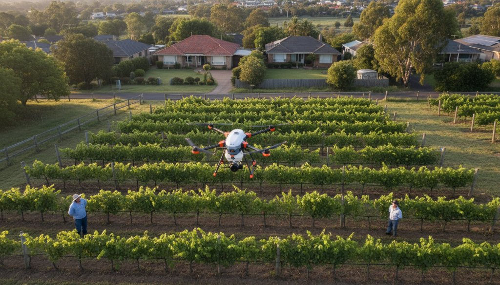
Gone are the days of manual, time-consuming field inspections. Drones offer an efficient, accurate, and comprehensive way to monitor crop health, assess irrigation effectiveness, and identify potential issues before they escalate. For properties in and around Doncaster, whether they are market gardens, small vineyards, or specialised crop producers, this means making data-driven decisions that significantly improve outcomes. Imagine identifying nutrient deficiencies in specific areas of a paddock before they become visible to the naked eye, or precisely mapping water flow to prevent wastage.
Our sophisticated drones are equipped with multispectral and thermal cameras, capable of capturing data far beyond what standard photography can achieve. This allows us to create detailed health maps, elevation models, and plant count analyses, providing a holistic view of your operation. This level of detail is critical for implementing variable rate applications of fertilisers, pesticides, or water, ensuring resources are allocated precisely where they are needed, reducing waste and environmental impact.
The SkyShots Advantage: Local Expertise, Global Technology
At SkyShots, we understand the unique agricultural nuances of the Doncaster area and the broader Melbourne region. Our team combines expert piloting skills with a deep understanding of agronomy, ensuring the data we collect is not only accurate but also actionable. We pride ourselves on delivering bespoke solutions tailored to the specific needs of your property, whether it’s a sprawling orchard or a compact urban farm.
From the first flight plan to the final data delivery, we ensure a seamless and professional experience. Our agricultural drone photography services are designed to integrate effortlessly into your existing farm management practices, providing insights that complement your knowledge and experience. We’re more than just drone operators; we’re your partners in cultivating a more productive and sustainable future.
Precision Agriculture in Action: Real-World Applications
- Crop Health Monitoring: Early detection of pests, diseases, and nutrient deficiencies through advanced spectral imaging.
- Irrigation Optimisation: Detailed mapping of water distribution and plant stress levels to ensure efficient water usage.
- Yield Prediction: Accurate assessment of crop stands and plant vigour to forecast harvests more reliably.
- Topographic Mapping: Creation of precise 3D models of terrain for land levelling, drainage planning, and infrastructure development.
These capabilities are invaluable for farmers looking to maximise their return on investment. The Victorian Government also offers resources and support for agricultural innovation, which can be explored further at Agriculture Victoria. Understanding the local context, even for those near urban centres like Doncaster, is key to successful implementation.
Why Choose SkyShots for Your Doncaster Farm?
We believe in building long-term relationships with our clients, providing ongoing support and insights that evolve with your agricultural needs. Our commitment to accuracy, efficiency, and exceptional customer service makes us the preferred choice for aerial solutions in Doncaster and beyond. Let us help you unlock the full potential of your land, turning data into dollars and ensuring your crops thrive.
Ready to see how precision agriculture can transform your farm? Contact SkyShots today for a personalised consultation and discover the future of farming from above.
Leave a Reply