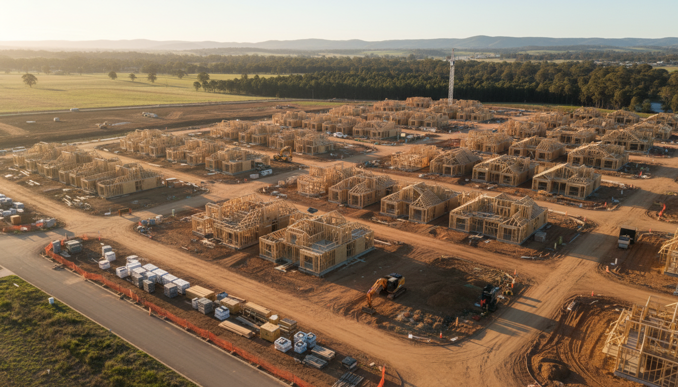
Officer construction drone progress monitoring has become an essential tool for developers managing the rapid expansion within this vibrant south-eastern growth corridor. As the landscape around the Princes Highway transforms from open paddocks into thriving residential communities, the ability to capture high-resolution, time-stamped data is invaluable. At SkyShots, we provide the technical precision required to document every stage of development, ensuring that stakeholders remain informed and projects stay on track. The suburb of Officer has transitioned from its rural roots into one of Melbourne’s most significant residential hubs, and our service allows for the precise tracking of this evolution.
The Benefits of Officer Construction Drone Progress Monitoring
The primary advantage of implementing aerial tracking is the sheer scale of perspective it provides. Traditional ground-based photography often misses the broader context of a multi-hectare site near Cardinia Creek. By utilizing our aerial drone photography services, project managers can overlay site plans with actual progress, identifying potential logistical bottlenecks before they become costly delays. This level of oversight is particularly crucial in Officer, where infrastructure projects must align closely with the Victorian Planning Authority guidelines for the region.
Why Choose Aerial Monitoring?
- Accurate Volumetric Data: We help you calculate earthwork volumes with high precision.
- Safety and Compliance: Reduce the need for staff to enter hazardous areas for manual inspections.
- Enhanced Reporting: Provide investors with professional visual updates that are easy to understand.
- Streamlined Workflow: Identify equipment placement and site access issues from a bird’s-eye view.
Enhancing Stakeholder Communication
Whether you are developing near the Arena Shopping Centre or closer to the newer estates by Dragon Park, clear communication is the backbone of a successful build. Our drone imagery provides a “single source of truth” for investors, council members, and contractors. Instead of lengthy site walks, a quick review of high-definition orthomosaic maps allows everyone to see the exact status of earthworks, slab pours, or roofing. This transparency builds trust and facilitates faster decision-making across the board, ensuring the project’s organisation remains tight and transparent.
Detailed Mapping and Precision Technicals
Our technology goes beyond simple photos. We offer detailed 3D modeling and topographical data that help engineers understand the contours of the land in Officer. By capturing consistent flight paths over several months, we create a visual timeline that shows the evolution of the site. This historical record is not only useful for current projects but serves as a powerful marketing tool for future developments. At SkyShots, we aim to optimise the data collection process, giving you more time to focus on the build. You can see examples of our work and get in touch via our contact page to discuss your specific site requirements.
In a competitive market like Officer, staying ahead means embracing the best technology available. Let SkyShots help you visualise your success with professional aerial monitoring that delivers results. By integrating our aerial surveys into your regular reporting cycle, you can ensure that the vision for a high-quality living space in the Cardinia Shire is being realised exactly as designed. Contact us today to schedule your first flight and experience the SkyShots difference.
Leave a Reply