In the bustling heart of Melbourne’s western suburbs, Sunshine is a hub of development and innovation. As new transport routes and crucial infrastructure projects shape its future, the demand for unparalleled accuracy and efficiency is at an all-time high. This is precisely where Sunshine Vic heavy civil drone surveys by SkyShots come into their own, offering revolutionary solutions for monitoring, mapping, and managing large-scale civil engineering works.
The Sky-High Advantage for Heavy Civil Projects
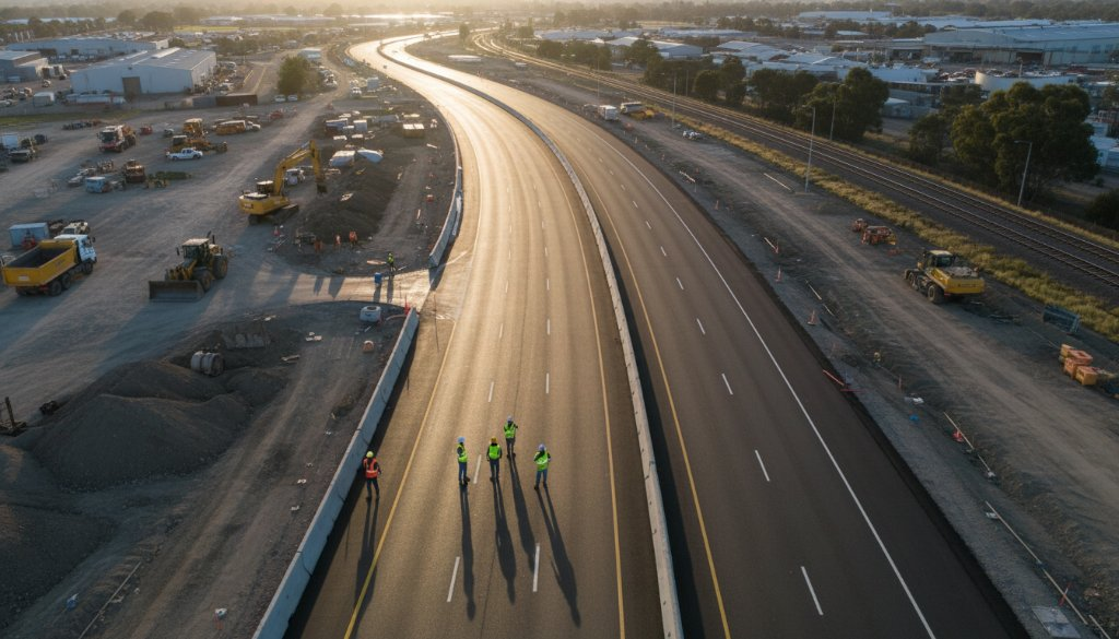
Gone are the days of manual, time-consuming, and often hazardous traditional survey methods. Drone technology has utterly transformed the landscape of heavy civil and transport infrastructure development. From initial site assessments to final project delivery, aerial insights provide a level of detail and efficiency previously unimaginable.
For projects like road expansions near the Western Ring Road or the development of new industrial parks, precision is paramount. Drones equipped with high-resolution cameras and advanced sensors can capture vast amounts of data quickly and safely. This data can then be processed to create detailed topographical maps, 3D models, and progress reports, giving project managers a comprehensive overview at every stage.
SkyShots: Your Local Partner in Sunshine’s Development
As a local Australian business, SkyShots understands the unique challenges and opportunities within Melbourne’s west. We’ve watched Sunshine evolve, from its historical industrial roots to its current status as a vibrant growth corridor. Our team brings not just cutting-edge drone technology but also an intimate knowledge of the local terrain and regulatory environment, ensuring seamless operation for your project.
Whether it’s monitoring earthworks for a new overpass or capturing the progress of utilities installation around Ballarat Road, our aerial photography and drone videography services are tailored to meet the exacting standards of heavy civil construction. We pride ourselves on delivering actionable insights that help keep your project on schedule and within budget.
To learn more about our comprehensive offerings, visit our construction drone photography page.
Beyond Imagery: Comprehensive Data for Informed Decisions
Our drone surveys go far beyond just pretty pictures. We provide crucial data for:
- Volume Calculations: Accurately measure stockpiles, cuts, and fills.
- Progress Monitoring: Document project milestones with highly repeatable, timestamped imagery.
- Site Safety Inspections: Safely inspect hard-to-reach areas, reducing risks to personnel.
- Environmental Compliance: Monitor environmental impact and remediation efforts.
These capabilities are invaluable for ensuring that large-scale infrastructure, such as the ongoing upgrades managed by organisations like Major Road Projects Victoria, are executed with the highest degree of accuracy and accountability. Our commitment to using Australian-standard practices and top-tier equipment ensures reliable and consistent results.
We work closely with project managers and engineers, providing regular updates and custom reports that integrate seamlessly into your workflow. Our expertise extends to generating highly accurate orthomosaics and digital elevation models, which are critical for precision planning and execution.
Choosing SkyShots for your Sunshine Vic heavy civil drone surveys means partnering with a team dedicated to excellence. We deliver the detailed visual evidence and data you need to make informed decisions, mitigate risks, and successfully complete your infrastructure projects. Let us elevate your next project with the clarity and precision only professional aerial expertise can provide. Discover more about our capabilities on our aerial photography services page or contact us today to discuss your specific requirements.
Leave a Reply