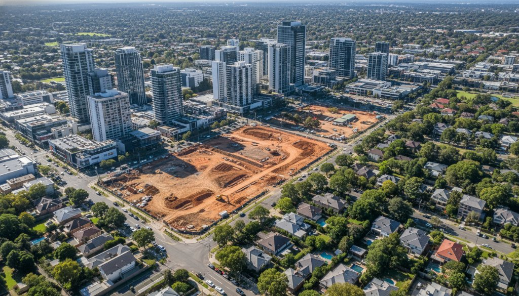
Box Hill, a vibrant heart of Melbourne’s east, is experiencing unprecedented growth and transformation. With multi-billion-dollar infrastructure megaprojects like the Suburban Rail Loop (SRL) East and North East Link traversing its established corridors, property development here is more dynamic and complex than ever. For developers, planners, and investors navigating this exciting landscape, truly informed decisions require more than just ground-level observations. This is where SkyShots excels, providing unparalleled Box Hill Property Aerial Insights SRL East Corridor Photogrammetry, offering a bird’s-eye view that reveals critical details impacting your projects.
Unveiling Box Hill’s Future: The Infrastructure Boom
The Suburban Rail Loop (SRL) East will redefine connectivity, with Box Hill as a key hub. Coupled with the North East Link and future SRL Airport connections, these projects represent a monumental shift. For Box Hill property owners and developers, understanding the direct and indirect impacts of these corridors is paramount. SkyShots provides the high-resolution data needed to assess these changes accurately, from initial site surveys to ongoing project monitoring. Our advanced aerial solutions offer detailed data for strategic planning.
Precision Beyond Sight: The Power of Box Hill Property Aerial Insights SRL East Corridor Photogrammetry
At SkyShots, we leverage cutting-edge aerial technology for comprehensive property overviews. Our services include commercial aerial photography, but our true strength is advanced data capture. We specialise in detailed topographic mapping, earthworks monitoring, and volumetric analysis for precise material calculations.
Utilising sophisticated photogrammetry, we transform raw aerial images into precise 3D models and point clouds. This allows for seamless 3D BIM (Building Information Modelling) integration, enabling architects, engineers, and construction teams to visualise and plan with greater efficiency. For projects in Box Hill, especially adjacent to the SRL East corridor, this detail is invaluable for impact assessments, design optimisation, and compliance.
From Planning to Progress: Real-World Applications
Imagine a complete, current 3D model of your Box Hill site before breaking ground, or detailed weekly progress reports. Our services support every project phase, from initial feasibility studies to ongoing drone construction progress monitoring, mitigating costly delays.
For more on the Suburban Rail Loop project, visit the official Victoria’s Big Build website. Understanding the broader context helps contextualise our detailed aerial data for your specific property.
Why Choose SkyShots for Your Box Hill Project?
SkyShots is your local partner in precision data. With deep roots in the Australian landscape and a thorough understanding of Box Hill’s unique development challenges, we combine local expertise with world-class technology. Our commitment to accuracy, efficiency, and safety ensures you receive the highest quality aerial insights, tailored to your needs. Whether managing infrastructure upgrades within the City of Whitehorse, our local council area, SkyShots provides the aerial intelligence you need to succeed.
Ready to gain an unparalleled perspective on your Box Hill property? Contact SkyShots today to discuss how our advanced aerial insights and photogrammetry services can elevate your next project. Let us provide the clarity you need to build the future, from the sky down.
Leave a Reply